Berkeley Hills vs Flats: How To Choose Your Location
May 7, 2026
May 7, 2026
Trying to choose between the Berkeley Hills and the flats? You are not alone. Many buyers love Berkeley as a whole, then realize the day-to-day feel can change a lot depending on elevation, street pattern, transit access, and even wildfire rules. This guide will help you compare the two in a practical way so you can choose the part of Berkeley that fits how you actually want to live. Let’s dive in.
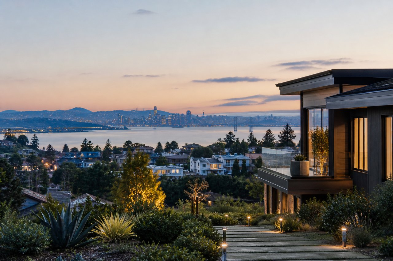
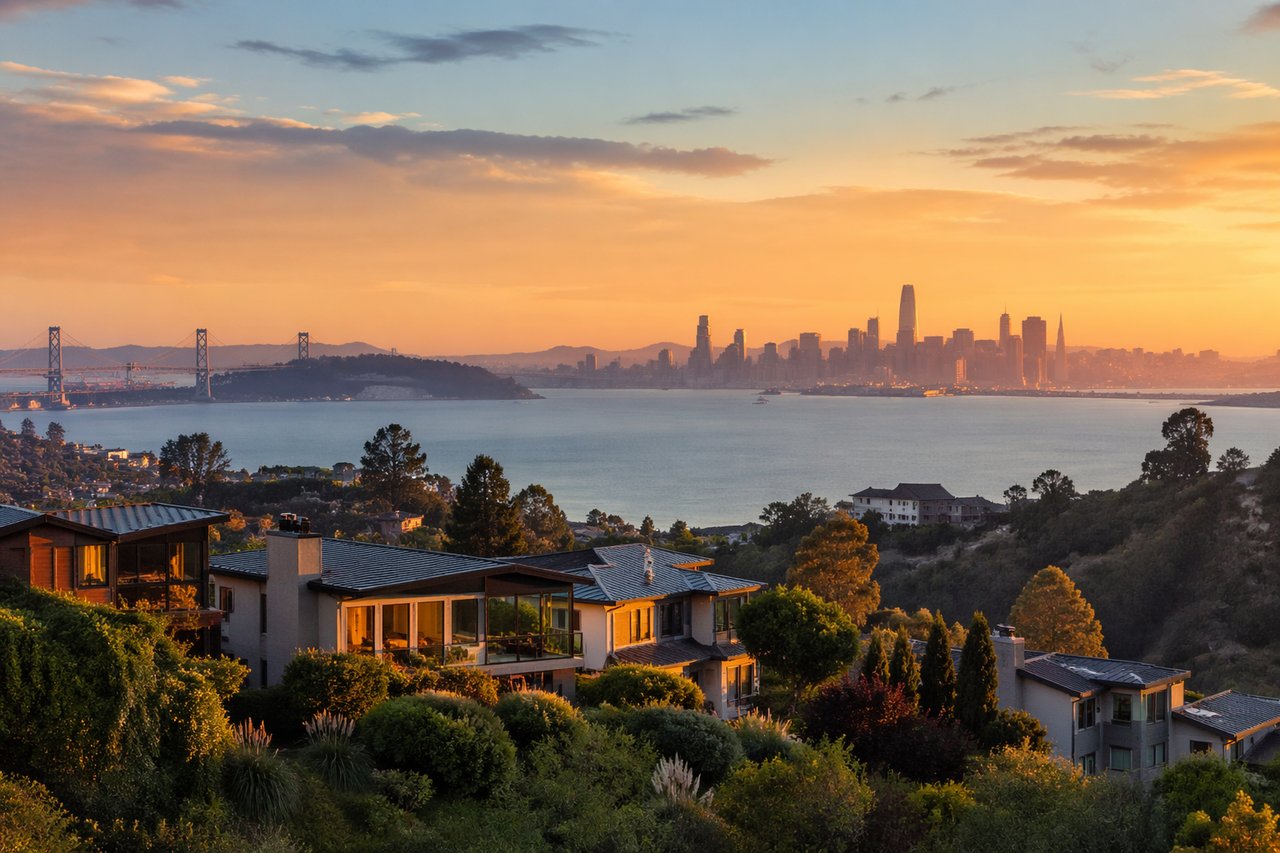
At the highest level, the choice comes down to views and open-space access versus flatter daily living and easier transit connections. The hills and ridge areas fall within Berkeley’s higher fire hazard zones, while the flatlands are defined by the city as the area outside those high and very high fire hazard severity zones.
That difference shapes more than scenery. It affects housing types, street design, home maintenance, transportation options, and what ownership may feel like over time.
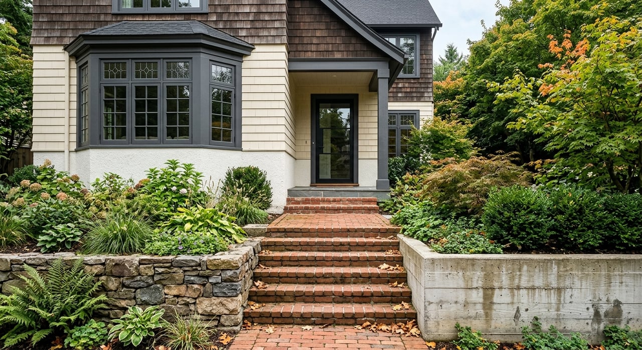
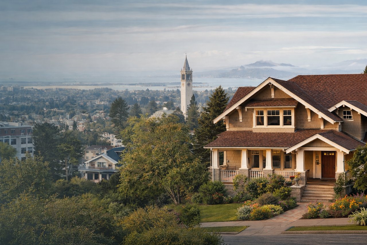
The Berkeley Hills tend to offer a more tucked-away residential setting. In places like Panoramic Hill, the city describes a woodsy hillside neighborhood with primarily single-family detached homes built from 1901 through the 1940s, plus west-facing views, custom home designs, balconies, and narrow roads that follow the land’s contours.
The hills also connect strongly to Berkeley’s open-space identity. City parks such as Remillard Park, Cragmont Rock Park, Indian Rock Park, and the Berkeley Rose Garden are all hill locations known for views, terraced or rugged terrain, and trail-like outdoor settings.
If you picture mornings with hillside light, mature landscaping, and a little more separation from busy commercial corridors, the hills may feel like home. In many cases, the tradeoff is steeper terrain and more route-specific access.
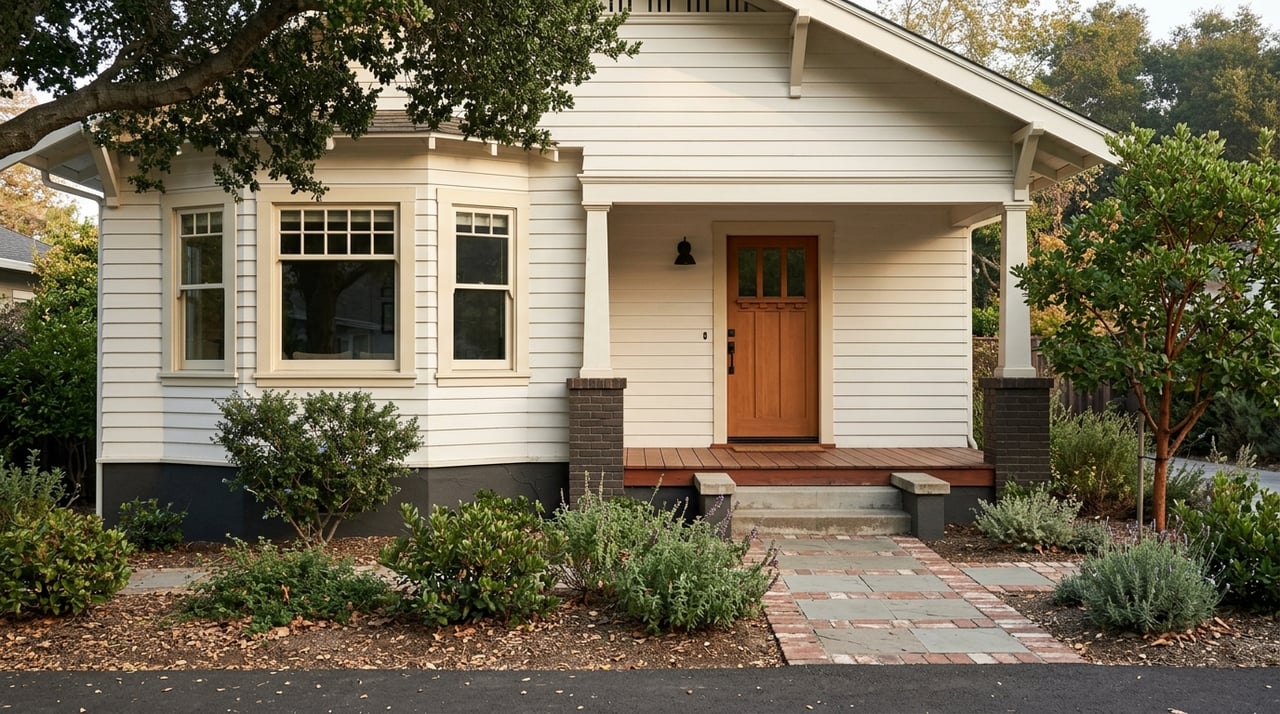
The flats tend to feel more connected to Berkeley’s everyday rhythm. In South Shattuck, for example, the city describes a mostly residential area with a mix of single-family bungalows, shingle houses, and small to medium apartment buildings, alongside commercial corridors that bring more activity, traffic, and parking congestion.
In practical terms, the flats usually offer a more urban and amenity-rich experience. You may find it easier to access shopping streets, transit, bike routes, and daily errands without dealing with the same elevation changes or winding roads common in the hills.
That convenience can come with more bustle. If you want a location where movement is flatter and neighborhood services feel closer at hand, the flats often check that box.
One of the clearest differences between the two areas is housing form. In the hills, buyers are often looking at detached homes on sloped or terraced lots, with decks, mature landscaping, and in some cases broad views.
In the flats, the housing mix is wider. Along with older bungalows and shingle homes, you are more likely to see small apartment buildings and a broader range of homes on the same block.
That variety may become even more noticeable over time. Berkeley’s Middle Housing zoning changes, effective November 1, 2025, apply to many lower-elevation neighborhoods and allow duplexes, triplexes, fourplexes, courtyard apartments, and other small-scale multi-family housing types on single lots. The city says these changes apply in many neighborhoods near Downtown, Elmwood, Fourth Street, North Shattuck, Solano, Telegraph, Lorin, West Berkeley, San Pablo, and University Avenue, while high-fire-hazard hill areas are excluded.
For many buyers, this is the biggest practical difference. Berkeley’s hillside and ridge areas are in the higher-hazard wildfire zones, and that brings added building and maintenance requirements.
For example, in Fire Zone 2, roofs must meet Class A standards, and wood shakes or shingles are not allowed for roof coverings. The city also offers wildfire-mitigation support that is especially relevant in hill areas, including a chipper program, vegetation debris bins in higher-risk hill neighborhoods, home-hardening mesh and gutter guards for some residents in Zones 2 and 3, and annual inspections of certain hillside properties.
The lifestyle piece matters too. Berkeley advises hill residents to leave before a fire starts when Extreme Fire Weather is declared, and the city emphasizes defensible space, vegetation removal, and home-hardening steps.
That said, wildfire awareness is not only a hills issue. Berkeley’s guidance says homeowners should remove flammable material within 5 feet of the home and thin vegetation on the property regardless of where they live.
If you want to live car-light, the flats generally have the edge. Berkeley’s main BART access points and many of its bus, bike, and parking resources cluster in lower-elevation areas.
Downtown Berkeley BART is close to UC Berkeley and to shops, restaurants, theaters, and other attractions. The station does not have parking, though the closest station parking is at North Berkeley or Ashby. North Berkeley BART offers parking and access to the Ohlone Greenway, and Ashby BART also has parking and a bike station.
AC Transit also reflects the hills-versus-flats split. Line 27 serves Downtown Berkeley, Bancroft Way and Durant Avenue, College Avenue, and Ashby Avenue. Hill routes such as lines 65 and 67 connect Downtown Berkeley with higher-elevation destinations including Lawrence Hall of Science, Senior Avenue, Grizzly Peak Boulevard, and Spruce Street.
The practical takeaway is simple: transit exists in both parts of Berkeley, but the flats usually offer a denser and more direct network. In the hills, your exact address matters more.
Parking is another place where geography shapes your routine. Berkeley’s city-owned parking facilities are concentrated in Downtown, Southside, and Elmwood, making the lower-elevation parts of the city more parking-infrastructure-rich than hill neighborhoods.
At the same time, city planning documents note traffic and parking congestion in areas like South Shattuck. So while the flats may offer more infrastructure, they can also bring more competition for space.
For biking, the flats are generally more connected. Berkeley identifies seven bicycle boulevards as optimal cycling routes, and the Southside includes protected bike lanes on Bancroft, Dana, and Fulton, along with bus-only lanes on Bancroft and Durant. In the hills, access is more route-specific because of grade, street width, and winding road patterns.
A helpful way to decide is to think less about labels and more about your daily habits. The right fit often comes from how you want your mornings, errands, commute, and weekends to feel.
The main tradeoffs are steeper streets, narrower roads in some areas, less transit density, and more wildfire-preparedness responsibilities.
The main tradeoffs can include more activity, more traffic in some corridors, and parking congestion in certain locations.
Before you fall in love with a specific house, it helps to zoom out and look at the block, route, and parcel. In Berkeley, small location differences can have a big effect on the ownership experience.
Ask yourself:
For parcel-specific research, Berkeley’s Community GIS Portal is the city’s official tool for checking zoning, transportation, recreation, and fire-related layers by address.
Neither area is better in a universal sense. The Berkeley Hills generally make more sense if you prioritize views, detached homes, and proximity to open space and feel comfortable with steeper streets, more wildfire preparation, and a less transit-dense routine.
The flats generally make more sense if you prioritize flatter movement, transit access, housing variety, and easier access to everyday amenities. The best choice is the one that supports your version of daily ease, not just your wish list on paper.
If you want help weighing a specific Berkeley neighborhood, block, or property, Gretchen Roethle offers thoughtful, hyperlocal guidance to help you buy with clarity and confidence.
Stay up to date on the latest real estate trends.

What’s really happening in California real estate—and why local data tells a completely different story than national headlines.


Let us guide you through every step of your real estate journey.